
| Alphabetical overview |
|
The Danish Areal Information System
|
|
AIS-Frontpage AIS-maps interactive New! AIS-Report AIS-Metadata AIS-Data download AIS-Data on CD AIS Project partners AIS in the future AIS-Webmaster |
| Danish |
|
Miljøministeriet Højbro Plads 4 1200 Kbh K tlf: 33 92 76 00 |
Downloading of test-data:
View AIS-data with the free Map Viewers from:
| ESRI (Shape-format) | ArcExplorer | 12.8 MB |
| MapInfo | MapInfo Pro Viewer | 13.6 MB |
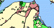
From the table below you may download test data from the Areal Information System:
The test data includes an area at Horsens Fjord.
The test data may be downloadet in a zipped format.
Click here for downloading the unzipping program: WinZip!
| ESRI Shape | KB | MapInfo | KB | |
| Land Use Map | Download! | 2941 | Download! | 3108 |
| Classification of Urban areas | Download! | 246 | Download! | 203 |
| Sea depth curves | Download! | 61 | Download! | 52 |
| Coastal and country borders | Download! | 23 | Download! | 31 |
| Streams | Download! | 215 | Download! | 221 |
| Lakes | Download! | 104 | Download! | 86 |
| Small lakes and ponds | Download! | 7 | Download! | 6 |
| Actual wetlands | Download! | 312 | Download! | 260 |
| Urban zones | Download! | 9 | Download! | 10 |
| Village demarcations | Download! | 10 | Download! | 9 |
| Landzone local plans | Download! | 8 | Download! | 7 |
| Summer residential areas | Download! | 4 | Download! | 4 |
| Protected types of nature (§3) | Download! | 174 | Download! | 141 |
| Nature and Wildlife reserves | Download! | 8 | Download! | 7 |
| EU-habitat | Download! | 8 | Download! | 5 |
| State reserves | Download! | 6 | Download! | 5 |
| Church reserves | Download! | 2 | Download! | 2 |
| Reserve areas | Download! | 11 | Download! | 9 |
| Drinking water sources | Download! | 42 | Download! | 38 |
| Camping sites | Download! | 3 | Download! | 3 |
| Youth hostels | Download! | 2 | Download! | 2 |
| Hotels | Download! | 4 | Download! | 5 |

|

|