
| Alphabetical overview |
|
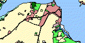
The Danish Area Information System
|
|
AIS-Frontpage AIS-Interactive maps New! AIS-Report AIS-Metadata AIS-Data download AIS-Data on CD AIS Project partners AIS in the future AIS-Webmaster |
| Danish |
|
Miljøministeriet Højbro Plads 4 1200 Kbh K tlf: 33 92 76 00 |
AIS - Interactive maps
It is now possible to see the themes of the Area Information System as interactive maps on the Internet!
By interactive maps is understood that the maps are shown on the screen together with GIS-tools, witch make it possible to Zoom, Find, Messure, Print etc.
The AIS-website now offers access to interactive maps in 3 different ways, each having specific strengths and weaknesses.
Before you choose witch type of service to use you should consider witch would meet your goals best.
The different types of services are shortly described here:
|
Interactive maps via an ordinary web-browser This service requires just an ordinary browser of newest version. You can Zoom, Pan, Find, Measure, Print etc. Of the 3 different services this one will have the smallest requirements to your hard- and software. It is not possible for the user to access extra themes to the browser. As all the processing runs on the server there can be a certain amount of updating delays depending of the speed of the internet connection. |
|
Interactive maps via a extended web-browser This service requires an ordinary browser of newest version extended with a java-applet from ESRI. You have to allow download and installation of this software, but you just have to install the java-applet once. Next time you log on the applet is ready to work. In this service the data will be retrieved as vector-graphic and stored in the RAM-memory of your PC. Because all the vector-data are retrieved to your PC, there might be a delay before the themes show up for the first time in the browser. Afterwards it contrary goes very fast because the data are stored locally. This service depends on your local web-browser and may cause difficulties. As an alternative, we recommend the use of ArcExplorer 4.0 (see below!) |
Interactive maps via your own GISIf you use one of the ESRI GIS-applications mentioned below you can look at map-services from diverse internet GIS map-services simultaneous.These map-themes can be combined with your own data stored locally on your PC or the local server’s hard disk. This method is faster than the other 2 types of services.
Read about ArcExplorer 4.0! Download ArcExplorer 4.0 and the matching applikation Java (JRE 1.3.1)! Get a user guide! AIS-data can be found at: http://195.41.77.42 |

|

|